r5 - 25 Jan 2009 - 02:58:31 GMT - VladAtanasiuYou are here: Bernstein > Main Web > GisServices > GisGallery
Preliminary examples of the Bernstein Atlas for Paper History
We show here some preliminary results of maps generated with data from the Bernstein databases (6902 locations).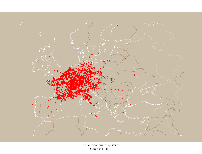
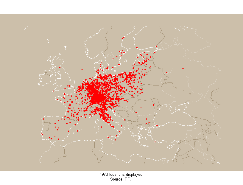
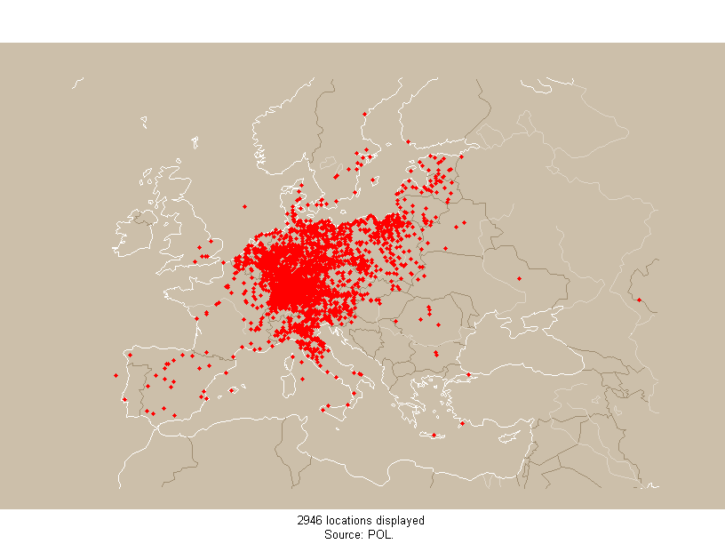
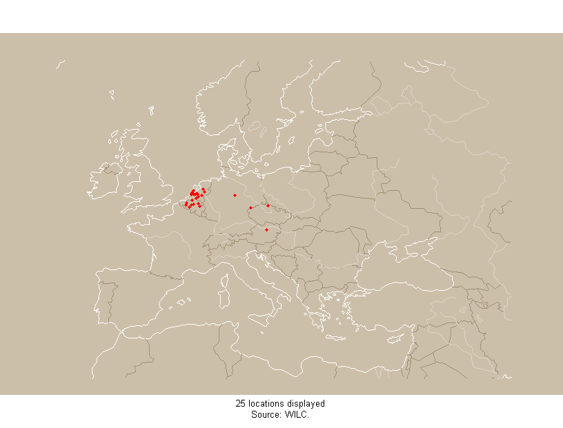
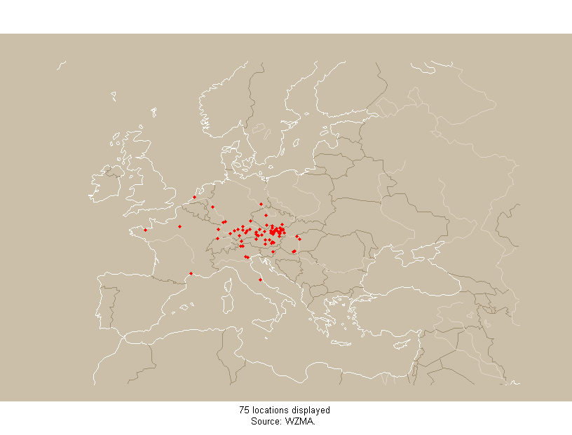 Map Series 1. These maps show the locations where papers from the Bernstein databases were used (ie documents written or printed). From top to down the sources are: Briquet Printed, Priccard Findbuch, Piccard Online, WILC, WZMA. There are notable differences in the point distributions and there are a number of reasons to that. WILC for example repertories exclusively documents from the Low Countries - hencec only locations from present day Netherland and Belgium appear. Although not thematically without set borders, WZMA reflects the activity area of the database developpers: mainly Lower Austria. The Briquet and Piccard maps reflect the regions where these scholars traveled to physically consult archives: for Piccard it is Germany and Northen Italy, for Briquet also France. Location distribution also reflect the varagies of political borders (see the outlines of the former German East Prussia and Königsberg provinces in the Piccard map), national cultures (the sparse location density for France reflects the centralisation typical for the country, as opposed to Germany where locations are more evenly distributed) or topographic features (the Alps). These and other factors converge and result in the uneveness characteristic maps representing cultural phenomena. Its implications have to be kept in mind for quantitative spatial evaluations.
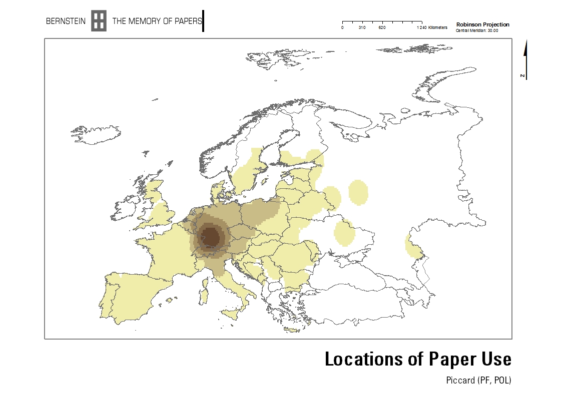 Map 2. Here we see the variation in density of locations in two of the Bernstein sources. The colors (colormap not represented) denote quantities of locations in a circular area around each mapped location. Clearly Piccard Findbuch and Piccard Online ahve their focus on South-Eastern Germany, the region most accessible to Piccard who was based in Stuttgart.
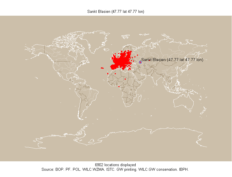 Map 3. Geolocation is a tedious, errorprone task. Although our sources concern only Europe, this map shows points way into Asia (a Sankt Blasien near Astrakhan on the Volga) or in Africa. These errors are due both to the sources used to complie the geographical coordinates and to the actual retyping by Bernstein researchers.
-- VladAtanasiu - 04 Mar 2008
| I | Attachment | Action | Size | Date | Who | Comment |
|---|---|---|---|---|---|---|
| | baph_all_pt.png | manage | 27.9 K | 04 Mar 2008 - 22:26 | VladAtanasiu | locations of all sources |
| | baph_bol_pt.png | manage | 28.8 K | 04 Mar 2008 - 22:26 | VladAtanasiu | locations of briquet printed |
| | baph_pf_pt.png | manage | 30.0 K | 04 Mar 2008 - 22:27 | VladAtanasiu | locations of piccard findbuch |
| | baph_pol_pt.png | manage | 29.3 K | 04 Mar 2008 - 22:27 | VladAtanasiu | locations of piccard online |
| | baph_wilc_pt.png | manage | 23.0 K | 04 Mar 2008 - 22:28 | VladAtanasiu | locations of wilc |
| | baph_wzma_pt.png | manage | 23.5 K | 04 Mar 2008 - 22:28 | VladAtanasiu | locations of wzma |
| | baph_pf_pol_pointdensity.jpg | manage | 244.9 K | 04 Mar 2008 - 22:29 | VladAtanasiu | density of locations in piccard findbuch and piccard online |
Main.GisGallery moved from Main.GisMapsExamples on 25 Jan 2009 - 02:58 by VladAtanasiu - put it back
COMMONS
WORKPACKAGES
* TOOLS SITE INFO |
| Copyright © by the contributing authors. Bernstein - The Memory of Paper http://www.bernstein.oeaw.ac.at Ideas, requests, problems regarding Bernstein? Send feedback | |
