Mapping workflow
This document presents a step-by-step guide for generating maps with the Waqwaq webservice.Step 1: Create a georeferences file
- Download the georeferences template.
- Open the file in a text editor such as Notepad++.
- Fill in the fields with the appropriate data. You can leave fields empty. If coordinates are not supplied the record will not be mapped. See the fields content description for details.
- Save the file with Unicode encoding
UTF-8, withjsonpas extension and an appropriate name.
Step 2: Publish the georeferences
Once the georeferences file ready, it has to be made accessible to the Waqwaq webservice by uploading it to any publicly accessible Internet address, such as your webpage. If you don't have one google for free homepage hosting services.Step 3: Visualize the georeferences
In a webbrowser copy the following:http://www.waqwaq.info/ws/main/main.html?url=http://www.myserver.com/geo.jsonpwhere
http://www.myserver.com/geo.jsonp should be exchanged for whatever Internet address points to your georeferences file.
 This application uses JavaScript - be sure the "JavaScript" option in your browser options is enabled.
Be patient while the map is loading. While the activity bar & text are active on the browser's status bar, the map has not yet finished loading.
This application uses JavaScript - be sure the "JavaScript" option in your browser options is enabled.
Be patient while the map is loading. While the activity bar & text are active on the browser's status bar, the map has not yet finished loading.
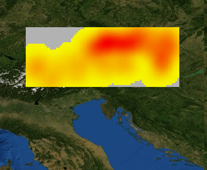
Option: Make a density map
You can make a map showing the spatial density of records in your map by following the next steps. The functionality works only if your data is on a webserver.- Fill
_template.pts.jsonwith the records numbers and coordinates in yourgeo.jsonpdataset and save it togeo.pts.json(the extension has to be.pts.json). - In
_template.ini.jschange// var pointsUrl = [];tovar pointsUrl = ["geo.pts.json"];and save the file togeo.ini.js. - After you uploaded both
geo.pts.jsonandgeo.ini.jsin the same webserver directory asgeo.jsonp, load the map (ex.:http://www.waqwaq.info/ws/main/main.html?url=http://www.myserver.com/geo.jsonp) and press the button in the "Density" section of the GIS interface to generate the density map.
Read how to generate just the density map in a map devoid of locations markers in MapSettings > "Large datasets".
Option: Customize default map proprieties
A number of default map proprieties such as initial map extent or content language can be modified as explained on the MapSettings page.Option: Download webservice code
If you wish to install this GIS application on your own server download to your server's http directory all files found in thehttp://www.waqwaq.info/ws/main/ directory and subdirectories. You can automated the process using a websites downloader, such as HTTrack.
Browser support
The Waqwaq software has tested to run on the following browsers:- Firefox 3.5.4, 3.0.6, 3.0.5, 3.0.14, 3.0.13 Win
- Internet Explorer 8.0.6001.18702 Win, 8 Win (IE7 Modus in HTML set), 7.0.5730.13 Win, 6.0.2900.5512 Win XPSP3, 6.0 Win with IE Developer Toolbar installed and activated (View > Toolbars)
-- VladAtanasiu - Mar 2009
| I | Attachment | Action | Size | Date | Who | Comment |
|---|---|---|---|---|---|---|
| | kd.png | manage | 184.4 K | 30 Aug 2009 - 17:10 | VladAtanasiu | Density map sample |
http://www.bernstein.oeaw.ac.at/twiki/bin/view/Waqwaq/MapWorkflow · r19 · 04 Nov 2009 · 15:22:41 · VladAtanasiu
Waqwaq: Mapping cultural geographies · http://www.waqwaq.info
Copyright © by the contributing authors. 2009-2014
Waqwaq: Mapping cultural geographies · http://www.waqwaq.info
Copyright © by the contributing authors. 2009-2014