Bernstein GIS Services
Following are products of the Bernstein project related to the cartography of papers.
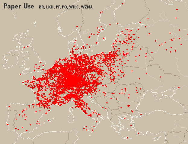
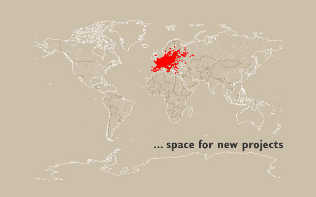
Peek view
This figure shows 4475 locations from the Bernstein databases where papers were printed, written upon or otherwise 'used' between the 14th and 19th century. See the map gallery for more samples.
Online Atlas
Bernstein Paper Atlas / Locations referring to papers and watermarks in Europe, 14th-19th century: places of paper use, repositories, incunabula printing places, bibliography, contextual information.
- Specific distributions according to users criteria of search in the Bernstein databases
- Reference distributions of the Bernstein databases
![]() Want to know how this is done? Check the GisSoftwareArchitecture page.
Want to know how this is done? Check the GisSoftwareArchitecture page.
Next development steps
- dynamic density visualization
- new data:
- up-to-date Bernstein reference distribution maps
- thrid party data
- comparison of multiple data sources
- better layout
- add bells and whistles
PaperDatabases / Geographical distribution of known databases of paper structure reproductions.
Datasets
Dalek / Georeferenced placenames of the Bernstein Paper Atlas.
Download: dataset, kml, nuts, documentation (2008.06.30)Next updates: completing IBPH and ISTC, adding NIKI
Reporting bugs on GisBugsGeodata.
Data content:
- Placenames (including variants)
- Coordinates
- Regions (administrative, geographical, historical and statistical)
Sources coverage (links to Google Maps):
- Paper: Briquet (paper use, repositories), Piccard (paper use in Findbuch, paper use in Piccard Online, repositories), Likhachev (paper use, repositories), WILC (paper use, repositories), WZMA (paper use, repositories)
- Incunabula: GW (printing places, repositories), ISTC (printing places)
- Context: IBPH (bibliography), Biraben (plague)
Yersinia / Spacetime referenced placenames of plague occurrences in Europe 1347-1600.
Download: dataset, animation, visualization, documentation (2008.06.30)Yersinia placenames are included in the Dalek dataset without the years of occurrence.
Tools
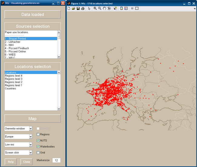
Wiz / Visualization tool for Dalek (the images below is done in Wiz)
Download: Matlab Runtime to install before the application, Windows application, Matlab sources code, installtion help, screenshot (2008.07.09)
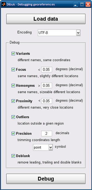
Dibuk / Tool for debugging georeferenced datasets
Download: Matlab Runtime to install before the application, Windows application, Matlab sources code, installtion help, screenshot (2008.07.09)Detects the following types of possible errors:
- Variants: same placenames and same coordinates
- Focus: same placenames with slightly different coordinates
- Homonyms: same placenames with sizeable different coordinates
- Proximity: different placenames, but very close coordinates
- Outliers: coordinates outside a given region
- Precision: rounding coordinates to a given number of decimals
References
- NUTS
- Concise description of what NUTS are: deutsch, english, français
- Official NUTS webpage
- NUTS regions maps
- names and codes list (Excel file)
-- VladAtanasiu - 21 Jun 2008, 24 Aug 2006
| I | Attachment | Action | Size | Date | Who | Comment |
|---|---|---|---|---|---|---|
| | Deliverable10_D2.2_GIS_Data_v1_2007.07.23.pdf | manage | 126.5 K | 12 Oct 2007 - 15:18 | VladAtanasiu | GIS status 2007.09.21 |
| | paper-use.jpg | manage | 138.8 K | 21 Jun 2008 - 23:24 | VladAtanasiu | Paper use map - Europe |
| | paper-use-world.jpg | manage | 41.7 K | 21 Jun 2008 - 23:27 | VladAtanasiu | Paper use map - World |
| | nuts2003.xls | manage | 237.5 K | 15 Nov 2008 - 21:00 | VladAtanasiu | NUTS names and codes (Excel fiel) |
| | dibuk-screenshot.jpg | manage | 53.4 K | 05 Apr 2010 - 08:25 | VladAtanasiu | dibuk screenshot |
| | wiz-screenshot.jpg | manage | 99.1 K | 05 Apr 2010 - 08:26 | VladAtanasiu | wiz screenshot |
|
COMMONS
WORKPACKAGES
*
TOOLS SITE INFO |
|
|
| Copyright © by the contributing authors. Bernstein - The Memory of Paper http://www.bernstein.oeaw.ac.at Ideas, requests, problems regarding Bernstein? Send feedback | |